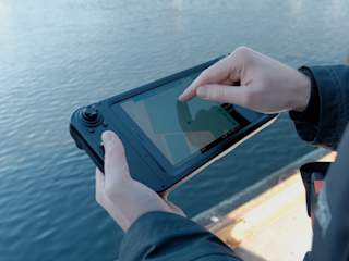
Blueye X3 Equipment
Blueye GPS
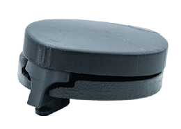
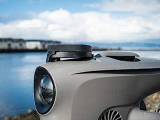
The Blueye GPS is mounted on top of the ROV and enables live position data when it's at the surface.
Blueye Robotics

Integrated in the Blueye app
No need for 3-party software. The app will detect the connected payload when a Smart Connector is plugged in one of the ROVs Guest Ports.
Live GPS position on the surface
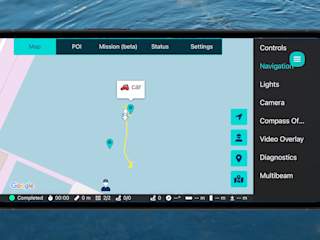
Log and track the ROV’s position when it’s at the surface. Tag points of interest to log your findings.
Position source for Mission Planning
Use the GPS as the position source when running missions in the Mission Planner.
Precision Positioning at the Surface
With the Blueye GPS you will get the live position of the ROV when it’s at the surface. This makes it easier to start your dive at a precise location. Also, if you want to mark a point of interest you find on the seabed, you can simply go to the surface and tag the position right away.
The GPS also allows Station Keeping when operating at the surface, which is convenient when waiting for an event during an operation, etc.
Smoother Missions with GPS + DVL
If the GPS is used in combination with a DVL, the ROV’s GPS position can be used as a starting point for the DVL’s dead reckoning. This greatly simplifies the user flow of underwater navigation, with no external equipment.
The GPS can also be used as the position source when running planned routes in the mission planner if you want to map an area with a forward-looking sonar or a side-scan sonar.

Technical Specifications
Blueye GPS
The Blueye GPS is mounted on top of the ROV and enables live position data when it's at the surface.

Performance | |
Accuracy | 1.5 m. Allows station keeping due to advanced filtering. |
Velocity Accuracy | 0.05 m/s |
Depth Rating | 500 m |
Time to First Fix (hot start) | 2 sec |
Time to First Fix (cold start) | 24 sec |
Supported Constellations | GPS, GLONASS, BeiDou, Galileo |
Antenna | Specifically designed to ensure strong reception when operating at the sea surface. |
Sea state | The system maintains accurate positioning even in rough sea conditions. |
Odometer | Enables you to measure the distance traveled. |
Electrical interface | |
Communications | NMEA over RS232 |
Power Supply | Operates on 14.8 V |
Power Consumption | 35 mA during continuous operation |
Peak Power Draw | 100 mA during peak usage |
Mechanical | |
Dimensions | 130 x 96 x 53 mm |
Weight in air | 250 g |
Weight in water | 0 g |
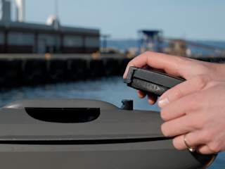
Mounting | Tool-free click-mount system for easy installation. Can be mounted on the top of the ROV in one of two positions: front or aft (rear). |
Related products: Navigation and positioning
-
![Closeup of the Blueye GPS on a Blueye X3]()
Closeup of the Blueye GPS on a Blueye X3
-
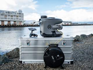
![Blueye GPS on a Blueye X3 outside with Zarges and Xbox controller]()
Blueye GPS on a Blueye X3 outside with Zarges and Xbox controller
-
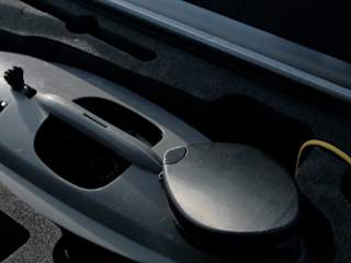
![The Blueye GPS mounted inside Zarges]()
The Blueye GPS mounted inside Zarges
-
![The Blueye App: GPS track leading to cap POI]()
The Blueye App: GPS track leading to cap POI
-
![The Blueye GPS: snap-on]()
The Blueye GPS: snap-on
-
The Blueye GPS
-
The Blueye GPS going upstream
-
![Running a mission in the Blueye App on a Rugged Controller]()
Running a mission in the Blueye App on a Rugged Controller
